Wednesday, July 17, 2013
Full Circle
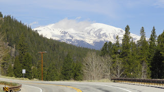
Departed Leadville to 35f and clear skies. Easy ride to the summit of Tennessee Pass. Stopped for photos and a snack before the downhill to Camp Hale, home of the 10th Mountain Division. The last big effort was the climb up Battle Mountain hill. From the top it is all downhill to our home in Gypsum, Colorado. The trip was a great experience and look forward to the next one. Glad to have a good shower and sleep in my own bed.
Place to Rest
It was 44f at 6:30 am when we left for Leadville. New pavement made for a smooth and fast climb toward our goal. Stopped at all the information boards and photo pullouts along the road. We passed 9000' elevation after 15 miles of riding, only 1,250' to go. Passed the turnoff to Independence Pass , which opens Memorial Day weekend, and travelers were lining up to be the first up the pass this season. We'll pass on that side trip. We crossed the Arkansas River headwaters and then on to Leadville. Got a room at the Alps Inn and headed for lunch and a walk about town.
Tuesday, July 16, 2013
Our Room For The Night
Moore Oklahoma was hit by an F-5 tornado last night. Left Poncha Springs at 8:20 am after pumpkin spice drinks and rollups. Stopped at the information boards 6 miles north of town. Had a couple big uphills and downhills on the way north on highway 285. Lots of views of fourteeners along the way. Arrived in Buena Vista
at noon with a visit to Subway before locating our inn for the night. We did a walk about town and took in the history of the early days. Walked across the street for Mexican Food before turning in.
Monday, July 15, 2013
Relaxing
It was 28f when we left the laundry room this morning. Steady uphill all the way to Poncha Pass. Photos at the summit and then a 7 mile descent to Poncha Springs. Checked in to Poncha Lodge and had lunch at the ice cream store next door. Just had to try the new hottub. Truely outstanding. We'll be ready for tomorrow after this refreshing soak.
The Laundry Room
Subway sauage and egg for breakfast. Aired up the trike tires after yesterday's flat on Dee's front tire. Easy ride on highway 112 to the junction of highway 285. After a diet cherry pepsi and a pee call we headed north. This up coming section of road is one straight line. Viewed the wild birds at the Russell Lakes Wildlife Area and then on to Saguache. After a potty break and a snack we were off to the San Luis RV Park and Campground. The north winds made for a slow and cold 18 miles. When we checked in the owner said we could sleep in the laundry room rather than set up our tent in the high winds. Can't turn down that kind of a deal.
Little Ones
Started the climb up the pass at 7:15 am. The grade was constant for 8 miles. The weather got worse as the morning moved along toward noon. By the time we reached the summit it was just above 32f and snowing. As the temperature warmed on the downhill descent the snow turned to rain and the warm asphalt created thick road fog forcing us to pull off the road for safety concerns. The temperature was 60f in South Fork and we needed some warm food. After eating we decided to ride on to Del Norte. We saw these little buffalo and their mothers on the way. A true sign of spring verses the snow we encountered earlier today.
Can't Be Seen
The road fog on the downhill descent was so thick we were hidden from view. We pulled off the road for our safety.
Sunday, July 14, 2013
Treasure Falls Rest Area
It was 33f when we got up at 6am. Packed up camp and had peanut butter rollups and then hit the asphalt at 7:45 am. Stopped at a historial marker and read about the Spainish Trail and a knife fight at the hot springs. A grocery stop in Pagosa Springs and a couple subways, one for lunch and one for supper, and off we went. A nice scenic ride through the valley to Treasure Falls. We hiked to the falls and the overlook taking lots of photos along the way. Camped at the abandonded restrooms near the parking area.
Relaxing with a good book
It was a cool 36f when we left the Sky Ute Campground at 6am. We rode Buck Road, a backroad shortcut, to Bayfield. Extra clothes off here before hitting highway 160 east. We did our first pass, yellowjacket, just east of Bayfield. Road paving for about 15 miles with lots of stop and go traffic. We like bringing up the rear as we can ride free of traffic until the next "go group" catches up to us. Took a break at Chimney Rock for a cold diet pepsi and a flush toilet. Made it to the Hide-a-Way RV Park and Campground mid-afternoon. Set up the tent, showered and did laundry before relaxing with our books. The campground owners, a young couple from Chili, warned us about the black bears that were hanging out in the area. Haven't worried about bears since our 2010 trip to Alaska.
Cow Bells
This highway supervisor stopped us and got this bell out of his truck and started ringing it and saying we were the first riders he'd seen today. We thought we were going to be in real trouble as we were riding through a 15 mile long road paving project, guess not. We all chatted for awhile and then on down the we went.
Subscribe to:
Posts (Atom)


